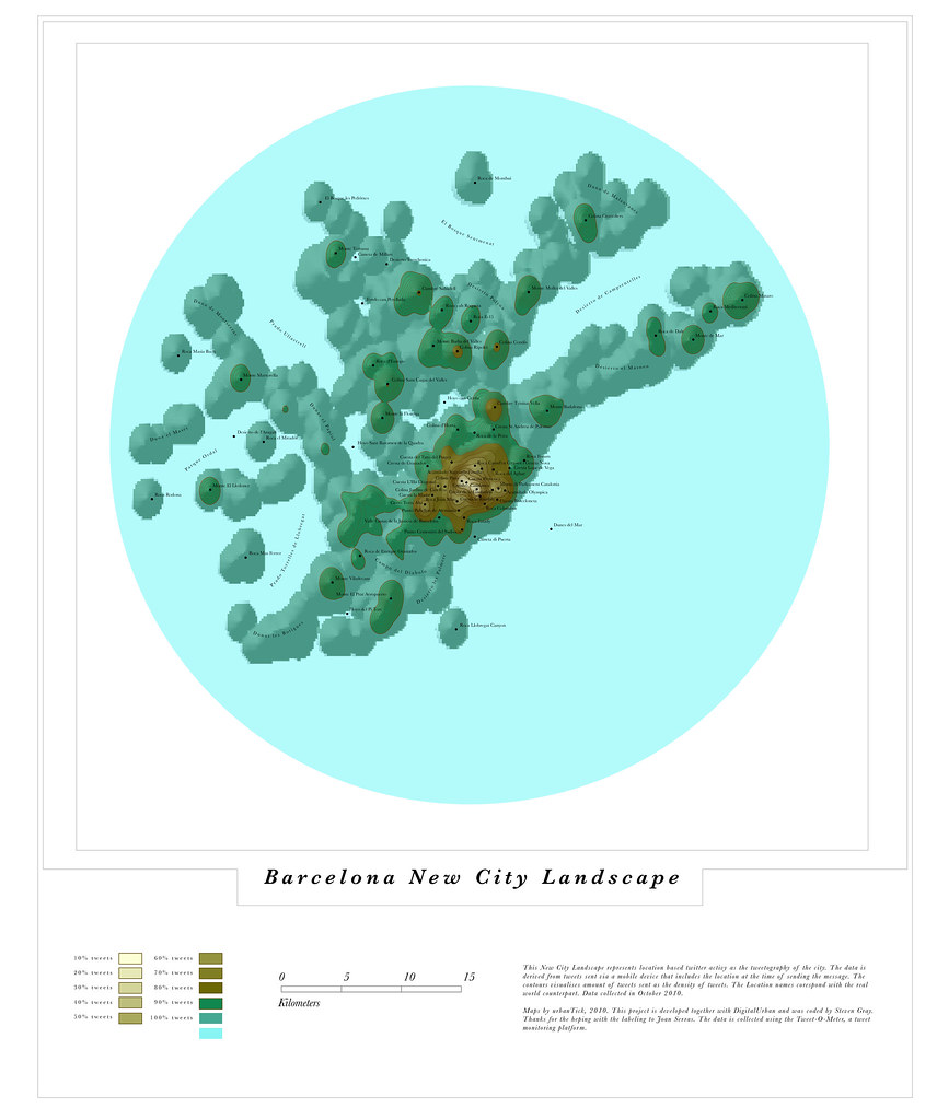
The highest point is just over the Placa de Catalonia with a steep slope down la Rambla to the Roca Columbus. Other places of high activity are around the parliament, here the 'Monte di Parliament Catalonia' and around the Olympic centre on Montjuic.
The overall structures are also visible on the twitter map. The boundary of the sea on the souther side of the urban area and the hills and valleys in the northern part for example. Especially the vallies and how they flow into the centre of the city are reflected in the NCL map with fingers going out along these lines.
Barcelona New City Landscape
Image by single-blogs using the GMap Image Cutter / Barcelona New City Landscape -Use the Google Maps style zoom function in the top right corner to zoom into the map and explore it in detail. Explore areas you know close up and find new locations you have never heard of. Click HERE for a full screen view.
The Barcelona map was generated from just over 24'000 lat/long geo located tweets collected the week ending 100715. Those came out of a sample of over 250'000 'Barcelona' twitter messages. Thanks to Joan Serras for the help with the labeling.

Tidak ada komentar:
Posting Komentar