The earthquake hit at 02:46:23 PM local time and was probably a aftershock of an smaller quake on March 9th that increased the tension in this already unstable region. The epicentre of the earth quake was located of the east cost of Japan about 200 km in the pacific. The closest metropolitan region is Sendai, but also Tokyo is only just over 300km away.

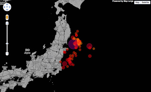
Image taken from mapLarge / The dots show the earthquakes logges on March 11 2011 surrounding the devastating 8.9 magnitude quake. Colour indicate time of report with dark being old, bright is new.
The movement of the pacific plate was described by experts on BBC news as several meters causing a massive tsunami wave rippling out through the pacific, of course first hitting Japan, but threatening all countries on its shore. Mainly Haiti was directly in line with the main force of the tsunami.

Image taken from BBC News / Direction and expected height of the tsunami caused by the 8.9 magnitude earthquake in Japan. The dotted line indicates expected times for the wave to travel.
Rescue and suport team around the world are on standby to be flown in if requested by the Japanese Government. Aid is being prepared and numerous charities. Online help and aid systems are coming up or are already running. Google has put up a platform for finding or reporting a missing person and the ushahidi open source mapping platform has released a specific platform for Japan. USGS is providing them maps and details on the earthquakes. For details see the list. NOAA provides the information on the tsunami in the pacific region. A live kml for Google Earth can be downloaded HERE, provided by USGS. Also earth quake related app for the iPhone or iPad are trending HERE.

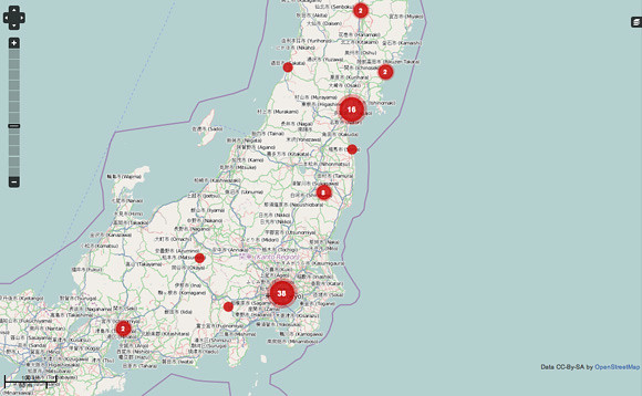
Image taken from ushahidi / Ushahidi platform for the 2011 Japan earthquake in March 11th. The red dots show the number of logged messages, informations and requests. The open source mapping intends to help by enabling to log info directly from the ground.
Even though Japan is well prepared and equipped the extend of this combination of tsunami and earthquake is devastating. In terms of architecture the regulations are very strict and buildings dealt well with the impact. Nevertheless, some serious damage has been reporte on infrastructure, most prominently issues with nuclear power plants, most of which have been shut down preventive.
In a sense all of these map conveys the temporal aspect as discussed in an earlier post. All that counts at the moment is time for Japan. The sooner they can get a hand on things the better. It is about evacuating injured and trapped individuals, secure and maintain infrastructure, supporting people in need and then it is also about rebuilding. Of course these are different time scales but things are running in parallel at the moment. This disaster is likely to have a long term impact, leaving scars in the public memory. Very similar to the also devastating Kobe earthquake.
With the recent natural disasters in Haiti (earthquake), Pakistan (flood), Christchurch (earthquake), Indian Ocean Tsunami (tsunami) having grabbed large scale medi attention this time will be no different not least because Japan is very well connected both politically and in terms of media. Mahups and especially social networking platform will be, actually already are, flooded with related content.
If you are interested in how you can help Good is running a good list that they intend to update as news come in.
Links via BBC, Map Room Blog, Good, Google Maps Mania
Tidak ada komentar:
Posting Komentar