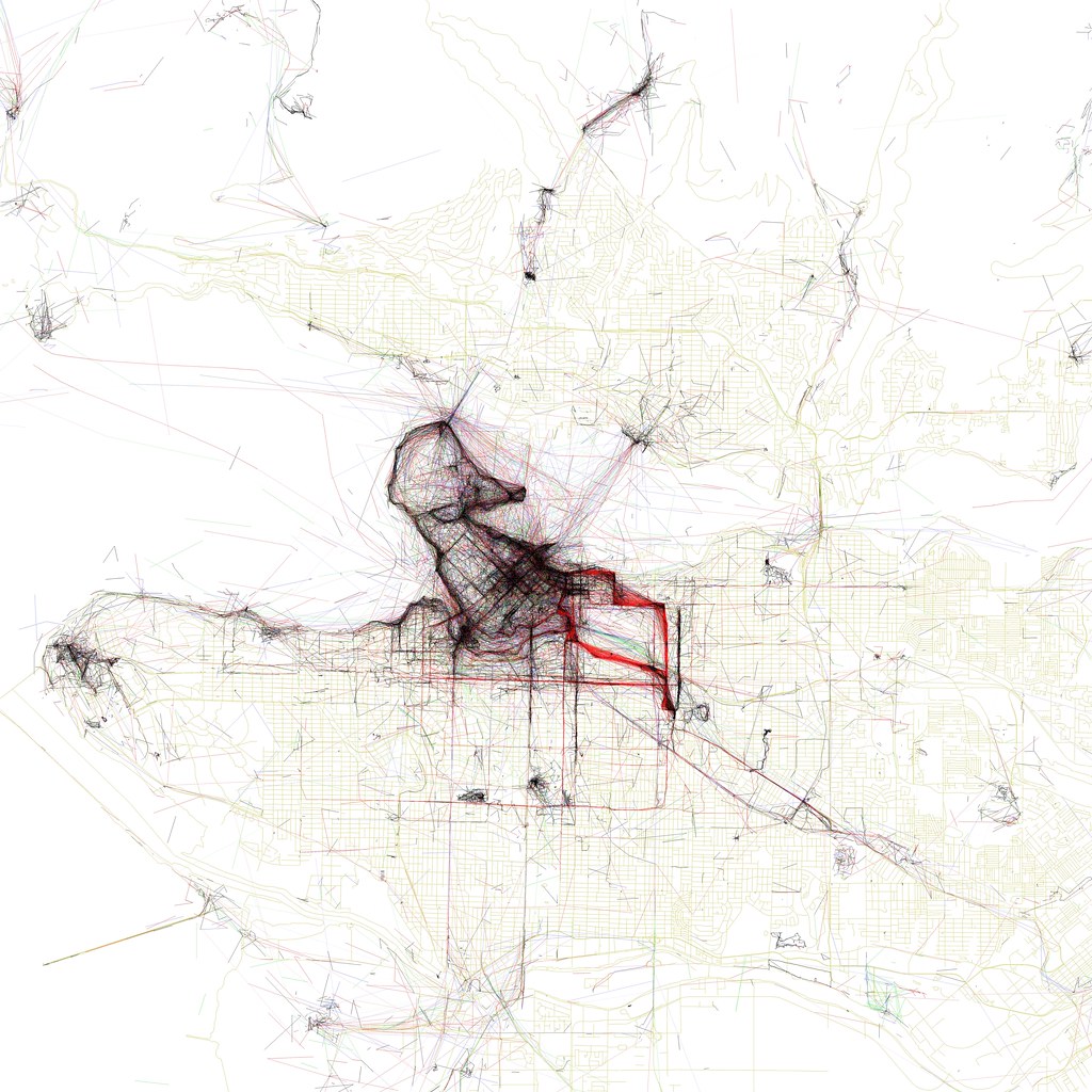
Fischer doesn't only plot the location, but takes traces movement by individual photographer including sort of classifying the mode of transport by speed derived from the time stamps. The differen colours read as: black is less than 7 mph (11 km/h), red is less than 19 mph (30 km/h), blue is less than 43 mph (69 km/h) - car, and green is faster.
This is an amazing collection rendered on top of an OSM background layer. Check out the rest of the cities in the flickr set.

Image by Eric Fischer / The Vancouver Duck, derived from geotaged flickr and picasa photographs. The colouring corresponds to speed of traveling between the different pictures.
Thanks for the link to Matt from Wiser is the Path.
------
2010-06-09 UPDATE
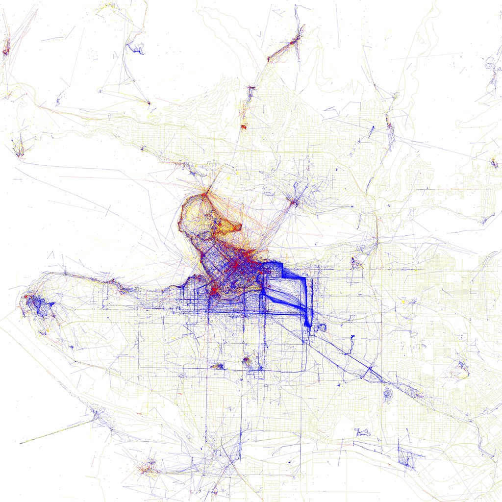
Eric has processed the data further and created a second set of maps of the world cities using the same sources. This time the focus is on who takes the picture and what is this persons relationship to the place. He works with thee categories, local, tourist and not to determine. This highlights the areas of which only locals take snaps in read and areas were predominantly locals, blue, take pictures. Very obvious there are places tourists just don't go to on a short visit to an unknown place, for a number of reasons. This can be lack of knowledge, not knowing the directions or not interested. On the other hand high profile places might not be very interesting for locals. In a lot of the maps large areas are actually covered in blue where locals document their city. New set can be found on flickr.

Image by Eric Fischer / The Vancouver Duck, derived from geotaged flickr and picasa photographs. Blue points on the map are pictures taken by locals (people who have taken pictures in this city dated over a range of a month or more).
Red points are pictures taken by tourists (people who seem to be a local of a different city and who took pictures in this city for less than a month).
Yellow points are pictures where it can't be determined whether or not the photographer was a tourist (because they haven't taken pictures anywhere for over a month). They are probably tourists but might just not post many pictures at all.
Thanks for the link to Ralph Bartel
Tidak ada komentar:
Posting Komentar